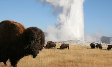
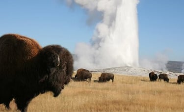
Yellowstone National Park Apps

Grand Teton National Park Apps


Yellowstone NP road condition QR Code
Scan this code to be taken directly to the NPS Yellowstone NP road condition website.
Alternate is to click here if you are unable to scan the QR code.


National Weather Service - Riverton, WY
Scan this code to be taken directly to the National Weather Service Riverton, WY website, they cover the Greater Yellowstone NP area, and this app can be very useful during your visit as the weather can change quickly here.
Alternate is to click here if you are unable to scan the QR code.
Dark Skies and Northern Lights
We are one of the best areas in the US to view the stars at night as we have very low light pollution in our area!
Discover and share the best places to observe the night sky. Mapping the best locations to observe the night sky powered by our community.
Map Information:
Qualification of astronomical observation sites
Light Pollution Map (ISTIL)
Human Footprint Map (GIBS/NASA)
Geolocation (only at the request of the user)
Search by city
Create a location with a simple click on the map
Bed and breakfasts for astronomy
Astronomical Observatories


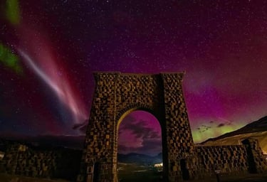
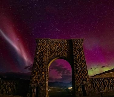
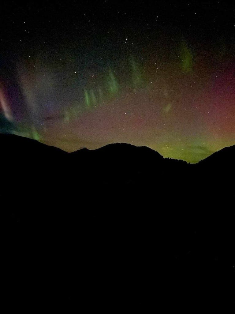
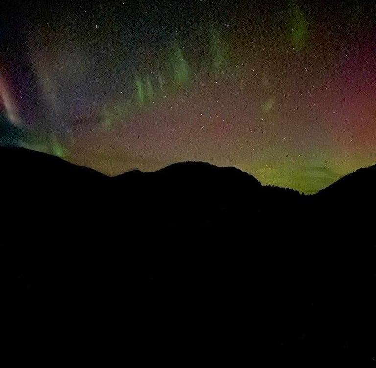
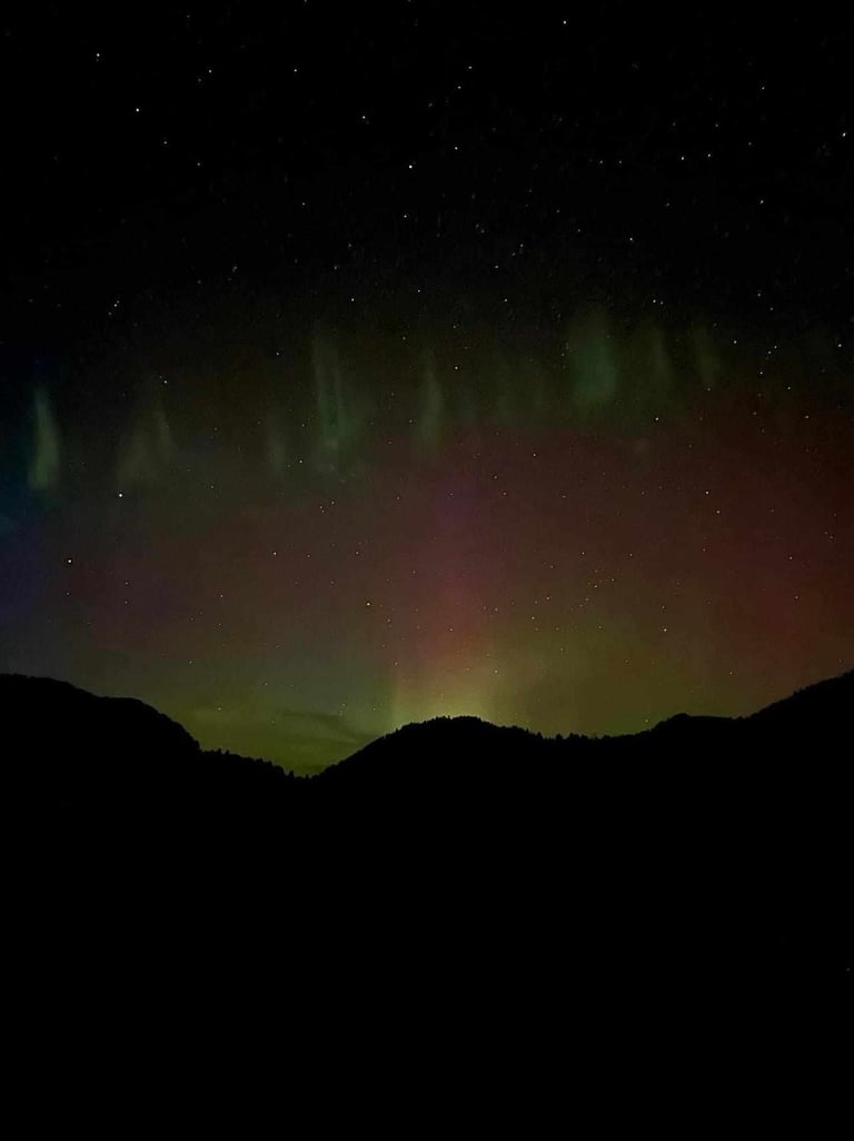
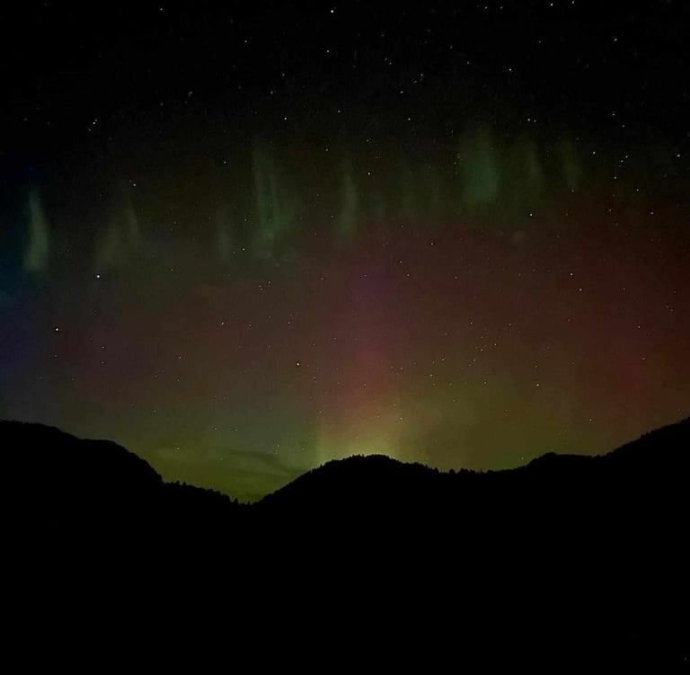
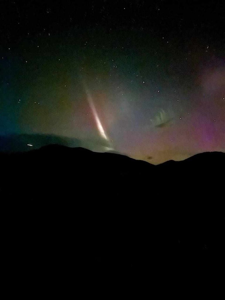
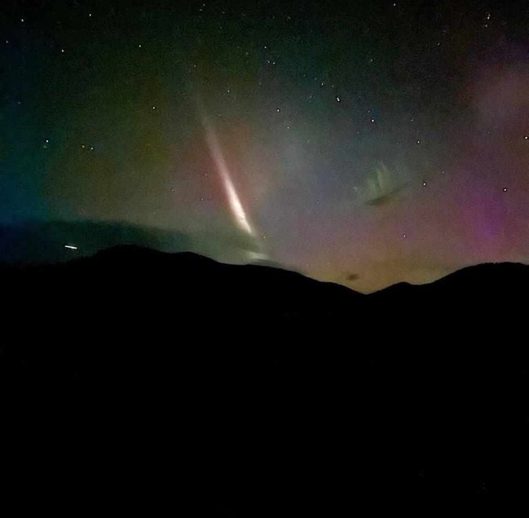
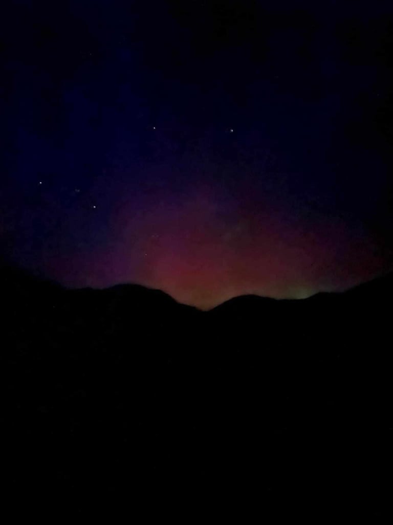
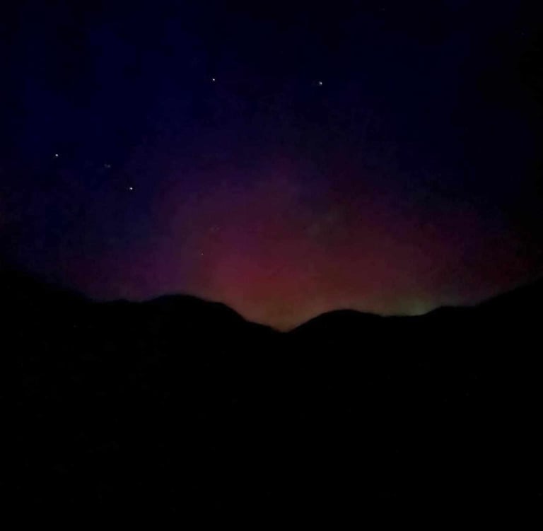
Northern Lights as seen from Little Trail Creek Cabins.
SkyView - iPhone App
SkyView® brings stargazing to everyone. Simply point your iPhone, iPad, or iPod at the sky to identify stars, constellations, planets, satellites, and more!
You don't need to be an astronomer to find stars or constellations in the sky, just open SkyView® and let it guide you to their location and identify them. SkyView® is a beautiful and intuitive stargazing app that uses your camera to precisely spot and identify celestial objects in sky, day or night. Find all 88 constellations as they fade in and out while you scan across the sky, locate every planet in our solar system, discover distant galaxies, and witness satellite fly-bys.
This App is only available on Apple Products


Star Walk 2 - Sky Map, Stars & Constellations - Android App
Identify Stars in the Night Sky is a great astronomy guide to explore the night sky day and night, identify stars, constellations, planets, satellites, asteroids, comets, ISS, Hubble Space Telescope and other celestial bodies in real time in the sky above you. All you need to do is to point your device to the sky.
Explore the deep sky with one of the best astronomical applications.
Objects and astronomical events to learn in this stargazing app:
- Stars and constellations, their position in the night sky
- Solar system bodies (solar system planets, the Sun, the Moon, dwarf planets, asteroids, comets)
- Deep Space objects (nebulae, galaxies, star clusters)
- Satellites overhead
- Meteor showers, equinoxes, conjunctions, full/new Moon and etc.
GyPSy Guide
-This app will work without cellular service in the park-
We’ll guide you to the all the best things to see and do, and suggest side-trips and local tips, so you don’t miss a thing. Listen to fun and informative stories about the history & culture, geology, hikes, animals, local peoples and highlights along the routes. Commentary plays automatically as you drive, based on your location. You have the freedom to travel at your own pace. Tour offline with GPS. No need for cell service or WiFi signal while touring. Everything is downloaded to your device for easy, offline use.
Visit our website www.gypsyguide.com to see a complete list of tour route maps, sample commentary, more travel tips & suggested itineraries.
KEY FEATURES:
Plays automatically as you drive, based on your location
Works offline with GPS, no cellular service, WiFi signal or data required while touring.
Trip Planning
- Suggested Itineraries
- Highlights
- Travel Tips
National Park Service
Let a park ranger be your guide! The National Park Service App is the brand new official app for all 420+ national parks. Find interactive maps, tours of park places, on-the-ground accessibility information, and more. The app was created by National Park Service staff—people who know national parks—to help you make the most of your visit. With all of these parks and a brand new app, it will take some time to finish creating content for each park. If you don’t find what you’re looking for now, check back regularly as our rangers work to complete the experience for each of our parks.
Unlike other apps, NPS Mobile takes authoritative information from park rangers and combines it with a great suite of features. Here’s a quick look at some of those features.
Interactive Maps: Each park has a detailed map that includes points of interest, along with roads, trails, and other information to plan your trip.
Park Tours: What is there to see? Self-guided tours take you to interesting places in the park. Discover popular destinations as well as places off the beaten track. It’s like having a ranger by your side to guide your trip, giving you suggestions for places to go, directions to get there, and things to do once you arrive.
Amenities: It's the little—and sometimes not so little—things that can make or break a park visit. Learn where you can find and access transportation, food, restrooms, shopping, and more.
Accessibility: The app offers a fully accessible experience with tools to benefit visitors with accessibility needs, such as audio descriptions of exhibits along trails and roads and in visitor centers.
Offline Use: No internet access? No problem! You can download content from entire parks for offline use. It’s especially handy if you’re exploring remote areas in parks or concerned about data limits.
Share Your Visit: Tell your friends and family about the fun things you did by creating and sharing virtual postcards with scenes from the park.
Things to Do: What do you want to do in a park—hike? Take a bus tour or scenic drive? Visit a museum? Join a ranger program? Become a junior ranger? Discover all the fun, entertaining, and educational activities parks have to offer.
News, Alerts & Events: What’s happening? Get news and events for all parks—or selected parks of your choosing.
And that’s just a start! The NPS Mobile app also includes passport stamp locations, fees, visitor center hours and locations, and more.
This one single app includes every one of the 420+ sites in the National Park System, no matter how big or small. Here are just some of the parks you'll find: Acadia, Arches, Big Bend, Bryce Canyon, Crater Lake, Death Valley, Everglades, Glacier, Golden Gate, Grand Canyon, Grand Teton, Great Smokies, Joshua Tree, Mammoth Cave, Mount Rainier, Mount Rushmore, Olympic, Redwoods, Rocky Mountain, Sequoia and King Canyon, Shenandoah, Statue of Liberty, Yellowstone, Yosemite, and Zion.
This App is only available on Apple Products

National Park Trail Guide is your comprehensive guide to hiking and site seeing in our National Parks.
National Park Trail Guide is your comprehensive guide to hiking and site seeing in our National Parks.
• Currently packing complete trail data and hike descriptions for many of your favorite National Parks, including life-list destinations like Yellowstone, Yosemite, Grand Canyon, Zion, Grand Teton, Mount Rainier, Point Reyes, Rocky Mountain, Zion, Acadia and many more!
• Search for hikes using the map or a park's “best of” list curated through star rankings from the community.
• Never get lost again! See your live position on a terrain or satellite map and vertical profile
• No cell signal needed. The data is available offline, and your phone uses its built-in GPS to show your location.
• Plan the perfect trip for you, using our hike difficulty ratings, elevation profiles, star ratings, and informed insights on seasons, camping and lodging, guided tours, food and drink, and more.
• Traveling with kids? We have an expert-selected list of Family Friendly Hikes. Want to target the park’s most beautiful features? View our list of Gems.
• Other cool features: Create a to-do list, track your hikes, or send your exact location to help in case of emergency.
• The app is completely free--it’s our gift to you as part of the National Park Service's Centennial Celebration.
By using GPS, we can show your location on trails and vertical profiles. Continued use of GPS running in the background can dramatically decrease battery life.
This App is only available on Apple Products
NPS Independence Junior Ranger
Become an Independence Junior Ranger with this official National Park Service app.
Have fun with any of the five interactive activities:
-Ring the Liberty Bell
-Sign your Declaration of Independence
-Create your own portrait
-Print on Benjamin Franklin's press
-Create your own seal.
Play one activity or play them all! Complete all five activities to earn your Junior Ranger certificate.
In the park? Show the certificate to a park ranger at the Independence Visitor Center to get your Junior Ranger badge.
This App is only available on Apple Products
PeakFinder AR - iPhone
The mountains are calling! Explore more mountains than any mountaineer! PeakFinder makes it possible… and shows the names of all mountains and peaks with a 360° panorama display.
This functions completely offline - and worldwide!
PeakFinder knows more than 850'000 peaks - from Mount Everest to the little hill around the corner.
This App is only available on Apple Products


PeakFinder - Android
The mountains are calling! Explore more mountains than any mountaineer! PeakFinder makes it possible… and shows the names of all mountains and peaks with a 360° panorama display.
This functions completely offline - and worldwide!
PeakFinder knows more than 850'000 peaks - from Mount Everest to the little hill around the corner.
This App is only for Android Products
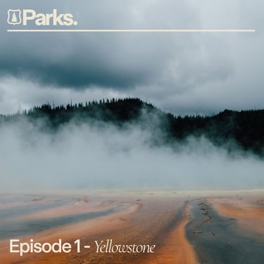
Parks Pod Cast
A podcast exploring the truth about the creation of U.S. National Parks, retold alongside Indigenous voices.